
The inspiring peaks of the Tata and Fata Mountains are a mighty natural barrier between Slovakia and Poland. Rich in natural resources and guardians of ancient trade routes winding through the steep alpine passes, the region is famous for spectacular vistas, mysterious ruins and charming mountain villages.
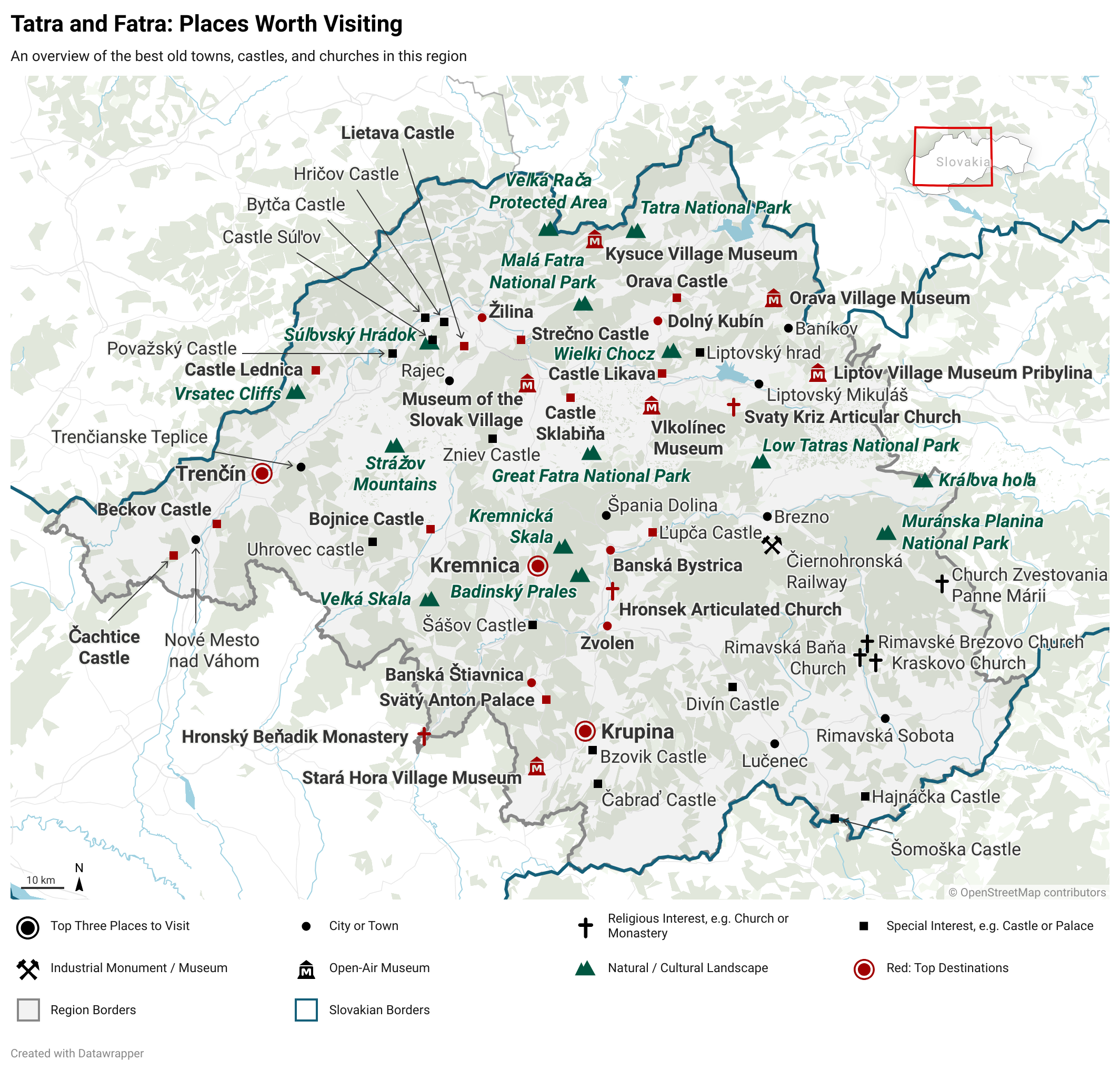
The lands of modern-day Slovakia comprised some of the core lands of the Hungarian Kingdom. On the Hungarian and Slovak Coats of arms today, you will find a cross emerging out of a set of three hills. Two of those hills are represented in this region, the Tatra and Fatra. As a territory of the Hungarian Kingdom, the Slovakian people had little say in how their lands were administered. Unlike the lands of the Holy Roman Empire and France, which often perpetuated ancient cultural or political borders, the lands of Hungary were fairly arbitrary divided into counties. The borders of Slovakia today are not evident in these counties, which tended to roughly traces the watersheds of streams and rivers. They also tended to be quite small, which makes looking a historical divisions of Slovakia quite difficult, as the Slovaks did not record any and the Hungarian terms for Slovakia are derogatory and colonial in nature, reflecting resource extraction and exploitation rather than identity. For this regions, I chose the three modern day administrative districts of Slovakia, covering Trenčín, Banská Bystrica and Žilina. These districts include the core region of the High-Western Carpathian Peaks of the Tatra and Fatra Mountains. This region was historically known for its mines, iron and gold in particular, and later some of Hungary first industrial enterprises. This gave some locales a certain degree of wealth, but most of the countryside depended on substinence agriculture until well into the 20th century.


